Fire.airnow.gov
AirNow Fire and Smoke Map
Track wildfire smoke and air quality across the US with an interactive map showing PM2.5 pollution to help you prepare and stay safe during wildfire season.
See real-time wildfire smoke and air quality on a map
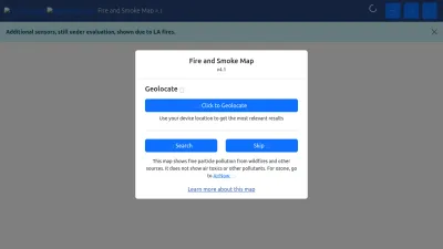
AirNow Fire and Smoke Map is an interactive online tool that helps you see real-time air quality information related to wildfires across the United States. The map displays fine particle pollution (PM2.5) levels from wildfire smoke and other sources, making it easy to understand local air conditions at a glance.
You can use the map to track current smoke patterns, check air quality in your area, and learn about protective actions to take during wildfire season. Whether you're concerned about your health, planning outdoor activities, or just want to stay informed, this site gives you the data you need in a clear, visual way.
Developed through a partnership between the EPA and US Forest Service, the Fire and Smoke Map is a trusted resource for anyone wanting to stay prepared and make informed decisions during wildfire events.
 Alternatives to Fire.airnow.gov
Discover websites similar to Fire.airnow.gov based on shared categories, topics, and features.
Alternatives with .gov Domain Extension
Browse daily, global satellite images with NASA Worldview to track weather, wildfires, air quality, and natural events in near real-time.
NOAA OSPO provides real-time satellite data and products for weather forecasting, climate monitoring, and hazard detection in the United States.
Access near real-time NASA satellite data and imagery for land, atmosphere, and weather monitoring, supporting research, forecasting, and disaster response.
Get real-time water data, flood maps, and forecasts across the U.S. with NOAA's National Water Prediction Service. Stay informed about water conditions.
Get real-time drought data, forecasts, and planning tools for the United States. Stay informed and prepared with resources from this official government site.
Get real-time tide, current, and water level data from NOAA. Access forecasts, maps, and oceanographic info to plan safe trips or monitor coastal conditions.
Explore climate and weather research, Earth system models, and scientific data to better understand environmental changes and predictions.
Get up-to-date marine weather forecasts and environmental data from NOAA's Marine Modeling and Analysis Branch for safer planning on the water.
South Coast AQMD provides real-time air quality updates, clean air plans, wildfire smoke info, and resources for Southern California residents and businesses.
NOAA Arctic shares U.S. government research, data, and updates about the Arctic region, including climate, weather, fisheries, and ocean science.
Learn about the U.S. Voluntary Observing Ship Program, access weather logs, and find resources for making and sharing maritime weather observations.
Get real-time tsunami warnings, alerts, and safety info from official U.S. Tsunami Warning Centers. Stay informed to keep yourself and your community safe.
Explore water-related topics and resources from the US EPA, including drinking water safety, water quality, infrastructure, and environmental protection.
Official site for the California Air Resources Board, offering news, resources, and programs to improve air quality and public health in California.
Official U.S. EPA site with news, resources, and information on air, water, climate, and environmental protection. Find updates, tips, and policy info.
Access water data from nearly 2 million sites across the US, including real-time streamflow, groundwater, and water quality information for research and planning.
Official site for Washington State Department of Ecology, offering environmental info, permits, data, and tools for protecting Washington's environment.
Official site for Bay Area Air Quality Management District, offering air quality updates, resources, and ways to support cleaner air in the Bay Area.
Official site of Florida's Department of Environmental Protection, offering resources, updates, and services for protecting Florida's air, water, and land.
Official site of the Vermont Department of Environmental Conservation, offering information on air, water, land, permits, and environmental programs.
Top Fire.airnow.gov Alternatives (Matching Language)
Check real-time air quality and pollution levels in Beijing and other cities, view historical data, and access air quality maps and resources.
Explore live global maps of wind, weather, ocean, and pollution conditions with interactive animations and real-time data, updated every three hours.
Get real-time satellite images and data on weather, climate, and the environment from EUMETSAT, supporting research and weather forecasting across Europe.
Get up-to-date weather forecasts, interactive maps, and severe weather alerts with Weather Underground's Intellicast tools and features.
Get local weather forecasts, long-term outlooks, and precipitation maps for Norway, provided by NRK and the Meteorological Institute. Norwegian language site.
Get detailed 12-day weather forecasts and interactive maps for thousands of locations worldwide. Check live updates on temperature, wind, and weather events.
Get up-to-date weather forecasts, animated maps, radar images, and air quality info for locations worldwide. Available in multiple languages.
Get up-to-date weather forecasts and maps for the UK, Ireland, and worldwide, including marine and travel weather, radar images, and climate data.
Get Sweden's latest weather forecasts, climate updates, and environmental data from SMHI, with expert insights and open data for public use.
Explore interactive geospatial maps and data for environmental analysis and insights with Earth Engine Apps. Visualize changes and trends easily online.
Get real-time METAR, TAF, and NOTAM weather reports for airports worldwide, decoded into easy visuals and maps. Supports flight planning and weather checks.
Check detailed weather forecasts, snow reports, and high-res maps for ski conditions and outdoor planning. Get reliable updates to plan your next adventure.
Get surf forecasts, live surf reports, and beach cams for 7,000+ surf spots worldwide. Check wind, waves, and tides before you hit the water.
World Meteorological Organization shares global weather, climate, and water data, offering updates, research, and resources for a safer, informed world.
Get Singapore's latest weather, air quality, dengue updates, and tips on recycling, cleanliness, and public health from the National Environment Agency.
View up-to-date drought maps and data for the U.S., compare trends over time, and explore regional impacts with interactive tools and downloadable reports.
Provides real-time flood control and river data for the Han River in Korea, including alerts, open data, and public information. Site is in Korean.
Get real-time and historical environmental and weather data from Iowa and the Midwest, with tools for analysis and charting. Run by Iowa State University.
Check live wind maps, weather forecasts, and radar for any location worldwide. Track conditions for outdoor activities with detailed, interactive weather layers.
Get high-resolution wind and marine forecasts for ocean racing, sailing, and boating with PredictWind’s advanced weather prediction tools.
More Fire.airnow.gov Alternatives
Check live weather radar, forecasts, and satellite images for the Netherlands and Europe. Get up-to-date rain, temperature, and weather alerts in Dutch.
Get real-time weather updates, forecasts, and hazard maps for the Philippines from PAGASA. Access rainfall, temperature, and storm bulletins easily online.
Explore global surface water changes over time with interactive maps and data. Track environmental trends and access downloadable geospatial datasets.
Get up-to-date weather forecasts, hydrology reports, and air quality info for Slovakia from the Slovak Hydrometeorological Institute. Site is in Slovak.
Get up-to-date weather forecasts, climate data, and environmental info for the Czech Republic from the official meteorological institute. (Czech language)
HungaroMet offers up-to-date weather forecasts, climate info, and alerts for Hungary, including local air quality and special meteorological reports.
BMKG provides up-to-date weather, climate, air quality, and earthquake information for Indonesia, helping you stay informed and prepared every day.
Get detailed weather, marine, climate, and air quality forecasts for Bulgaria, plus alerts and environmental updates. Site available in Bulgarian.
WindAlert helps you track live wind and weather conditions anywhere, with personalized alerts and detailed forecasts for water and air sports enthusiasts.
Get up-to-date weather forecasts, climate data, and environmental insights from Austria's official meteorology and geophysics institute. (German language site)
View live weather maps, track hurricanes and storms, and explore real-time satellite images and forecasts for your location on an interactive world map.
Surfline offers global surf reports, live surf cams, forecasts, and coastal weather updates, helping surfers plan the perfect session anywhere in the world.
Check live wind maps, weather forecasts, and wind speeds worldwide—perfect for sailing, kitesurfing, fishing, and other outdoor activities.
Official Korean government site offering tide tables, sea weather, ocean forecasts, and navigation charts for maritime safety and planning.
Access accurate global weather data and forecasts with Meteosource’s API, including minute-by-minute, hourly, and daily updates for any location worldwide.
Discover and connect with permaculture projects worldwide using an interactive map and database designed for the global permaculture community.
Get up-to-date UK weather forecasts, warnings, and climate information from the Met Office, with expert insights and tools to help you plan your day.
Get local weather forecasts, radar images, warnings, climate data, and research insights for Denmark, Greenland, and the Faroe Islands. Site in Danish.
Get up-to-date weather forecasts, climate information, and alerts for Norway from the Meteorological Institute. Includes news, reports, and weather warnings.
Get real-time ocean and coastal data for the Pacific Islands, including wave, weather, and environmental info to support safe and informed ocean use.