Plus.codes
Redirecting...
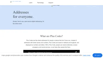
Plus Codes offers a simple way to share precise locations anywhere in the world, making it easy to find and navigate places without traditional addresses.
Share and find any location with a simple code
Plus Codes is a tool that lets you easily share and search for exact locations using unique codes, even if there's no traditional street address. You just enter or generate a Plus Code, and you can instantly pinpoint a spot on the map, making it useful for navigation, deliveries, or meeting up with friends.
The website is designed for anyone who needs a quick, accurate way to communicate locations worldwide—whether you're in a city or a remote area. It takes the guesswork out of finding places, especially where addresses are confusing or unavailable. With Plus Codes, you can always share your exact location with confidence.
 Alternatives to Plus.codes
Discover websites similar to Plus.codes based on shared categories, topics, and features.
More Plus.codes Alternatives
Explore interactive maps and geographic data with micmap.org—a simple online tool for viewing, searching, and understanding locations worldwide.
Thunderforest provides customizable map tiles and APIs for web and app developers, offering tailored cartography options and quick setup with friendly support.
LocationIQ offers affordable APIs for maps, geocoding, and routing, making it easy to add location features to your website or app with a generous free tier.
Get real-time tide, current, and water level data from NOAA. Access forecasts, maps, and oceanographic info to plan safe trips or monitor coastal conditions.
Mapillary lets you view, share, and collect street-level imagery worldwide. Explore maps, contribute photos, and access rich data for mapping projects.
Create and customize interactive maps for your web and mobile apps with developer-friendly tools, APIs, and geodata hosting from MapTiler.
OpenStreetMap offers a free, editable world map created by a global community, letting you view, use, and contribute geographic data online.
Find or share precise locations worldwide using unique three-word addresses for every 3 meter square. Great for navigation, deliveries, and emergencies.
Track ships in real time on an interactive map, view vessel positions, port activity, and marine traffic worldwide for free with My Ship Tracking.
Check your IP address and find out its location on a map, including city, region, and country. Easy IP geolocation lookup for privacy or security needs.
Explore and map global Wi-Fi networks with interactive maps, stats, and crowdsourced data from wireless network enthusiasts and wardrivers worldwide.
Google Maps Platform offers powerful APIs and tools for building custom maps, tracking assets, optimizing routes, and analyzing geospatial data worldwide.
Explore global electricity, telecom, oil, and gas networks on an interactive map built from OpenStreetMap data. Discover infrastructure worldwide at a glance.
NOSTRA Map offers detailed maps and geodata for Thailand, helping businesses with navigation, logistics, and location-based solutions. (Thai language site)
Ordnance Survey's Linked Data service has ended. Users are guided to OS Data Hub APIs for richer geospatial data, including OpenData and premium options.
Official Finnish government site for maps, land information, and property data. Access online services, research, and geospatial resources in multiple languages.
Download free vector and raster map data in multiple scales for mapping, analysis, and visualization projects. Perfect for geographers and cartographers.
Find and download free maps, geospatial data, imagery, and publications in English and French for research, planning, or exploration across Canada.
Mapbox provides AI-powered maps, navigation, and location APIs for developers to add dynamic mapping, geospatial data, and search to web or mobile apps.
Explore satellite maps and spatial data of India with ISRO's geoportal. Access detailed geographic information, tools, and visualization online.