Opendata.transport.nsw.gov.au
Transport Open Data Home Page | Transport Open Data
Find and explore open transport data, interactive maps, and insights for New South Wales. Access datasets, APIs, and tools for analysis and development.
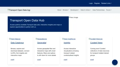
Explore and use NSW transport open data
Transport Open Data Hub is your gateway to a wide range of publicly available transport datasets for New South Wales. You can browse and download data, view interactive insights, or explore maps to better understand transport trends and patterns across the region.
Whether you’re a developer, researcher, or just curious about NSW transport, the site offers easy access to APIs, geospatial tools, and curated data views. There are also opportunities to connect with others, join innovation challenges, or partner on new projects.
With its user-friendly catalogue and multiple ways to interact with the data, this platform makes it simple to find, analyze, and use transport information for your own projects or research.
 Alternatives to Opendata.transport.nsw.gov.au
Discover websites similar to Opendata.transport.nsw.gov.au based on shared categories, topics, and features.
Alternatives with .au Domain Extension
Atlas of Living Australia gives open access to biodiversity data, letting you search, analyze, and share species information from across Australia.
Access and explore open data about South Australia, including datasets, visualizations, and tools for research, analysis, and community projects.
McCrindle provides data-driven insights and research to help businesses and organizations make informed decisions and improve their strategies.
Explore Australia's earth sciences with maps, data, news, and education resources from Geoscience Australia. Access earthquake info and scientific insights.
CoreLogic Australia offers property data, analytics, and news to help you make informed real estate decisions across Australia and New Zealand.
Top Opendata.transport.nsw.gov.au Alternatives (Matching Language)
ipdata offers a fast API to look up IP address locations and threat profiles, helping you localize content, analyze logs, and detect suspicious activity.
Manage and analyze massive multidimensional data cubes for science and research with flexible, scalable tools supporting open standards.
UniCourt offers a single platform for accessing litigation data, analytics, and insights—helping legal teams research, track, and manage court cases efficiently.
Explore and query linked data across the web with tools and resources that shift processing from servers to clients for more efficient data access.
Get daily satellite imagery and earth analytics to monitor changes, make informed decisions, and gain a multidimensional view of our changing planet.
Access and explore government environmental data, tools, and APIs from the UK Department for Environment, Food & Rural Affairs in one place.
Premise gathers real-time local data worldwide to help businesses and organizations make informed decisions through actionable insights and analytics.
Explore NASA's GRACE satellite data to track Earth's gravity changes and water movement, featuring scientific updates, research, and downloadable datasets.
Ordnance Survey's Linked Data service has ended. Users are guided to OS Data Hub APIs for richer geospatial data, including OpenData and premium options.
Explore Singapore’s open data portal for free access to national datasets, interactive charts, maps, and APIs to support informed decision-making and innovation.
Explore Edmonton's official open data portal for public datasets, interactive maps, and APIs designed for residents, developers, and the general public.
Explore and access open public data from the Portuguese government. Search, download, and reuse datasets for research, projects, or business needs.
Access and explore NASA Earth observation data, tools, and resources for land processes, all managed by the USGS LP DAAC in Sioux Falls, SD.
Development Seed creates geospatial tools and data solutions to help you better understand our planet and make smarter decisions about a changing world.
Access NASA's geospatial datasets and tools for Earth science research, with a unified interface for exploring, analyzing, and downloading data.
Access and analyze satellite imagery and geospatial data easily with interactive dashboards and powerful cloud-based tools for custom insights.
Look up any IP address and get detailed geolocation data with a fast, easy-to-use API that supports multiple formats like JSON, XML, CSV, and more.
Get fast, accurate IP geolocation data like country, city, and ISP with this easy-to-use API, available in JSON and XML formats for your apps and services.
Thunderforest provides customizable map tiles and APIs for web and app developers, offering tailored cartography options and quick setup with friendly support.
LocationIQ offers affordable APIs for maps, geocoding, and routing, making it easy to add location features to your website or app with a generous free tier.
More Opendata.transport.nsw.gov.au Alternatives
Access and download open political boundary data for countries worldwide. Explore, visualize, and use geospatial datasets for your projects.
Google Earth Engine lets you analyze satellite imagery and huge geospatial datasets online to map trends, monitor changes, and visualize Earth's surface.
SafeGraph offers curated global places data for accurate geospatial analytics, helping organizations map locations, analyze trends, and understand consumer behavior.
Find and access open government data from Vienna, including real-time info, maps, and statistics for personal, business, or research use. German language.
Explore NASA's Global Precipitation Measurement Mission for free satellite data, research tools, and the latest on Earth's rain and snowfall patterns.
Explore Austin's official open data portal for public datasets, maps, and dashboards to discover, analyze, and download city information and resources.
Element 84 delivers geospatial data processing and software solutions to help organizations analyze, visualize, and use earth data for positive impact.
Find detailed, accurate IP address data with IPinfo.io. Access geolocation, privacy, and company info by API or database for secure, reliable results.
AHN offers detailed elevation and geospatial data for the Netherlands, letting you view, analyze, and download height information and point cloud datasets.
Create and customize interactive maps for your web and mobile apps with developer-friendly tools, APIs, and geodata hosting from MapTiler.
Geocodio lets you quickly geocode US and Canadian addresses, append Census data, and more through spreadsheet uploads or a simple API. No hassle, just results.
The Graph lets you access and organize blockchain data easily, enabling developers to build apps without running their own servers or parsing raw data.
Google Maps Platform offers powerful APIs and tools for building custom maps, tracking assets, optimizing routes, and analyzing geospatial data worldwide.
Explore Mars climate data and research tools for scientists and enthusiasts, with detailed atmospheric models and resources for studying Mars.
Access ocean satellite data, forecasts, and analysis tools for monitoring sea conditions, altimetry, and seasonal changes. Ideal for researchers and ocean experts.
Explore and map global Wi-Fi networks with interactive maps, stats, and crowdsourced data from wireless network enthusiasts and wardrivers worldwide.
Access global 90m digital elevation data with the SRTM DEM database, offering improved, high-quality geospatial data for mapping and analysis needs.
Browse and download geodetic parameters, coordinate systems, and reference data for mapping, GIS, and geospatial analysis. Includes search and export tools.
Access and download New Zealand's official geographic and spatial data, maps, and records for free from the LINZ Data Service.
Explore, verify, and download official French address data with interactive maps, statistics, and community updates. Site available in French.