Geojson.io
geojson.io | powered by Mapbox
Create, view, and share spatial data easily with this online map tool. Draw maps, edit GeoJSON, and export your data in a few clicks.
Draw and share custom maps in your browser
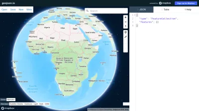
geojson.io is an easy-to-use web tool for creating, editing, and sharing maps and spatial data. Whether you want to sketch routes, mark locations, or visualize geographic information, you can do it all right in your browser without any software installation.
You can draw shapes, add points or lines, and instantly see your work on a map. The tool lets you import or export GeoJSON files, making it great for anyone working with mapping data—from students and hobbyists to professionals. Sharing your maps is simple, so collaborating or presenting your work is a breeze.
If you need a fast and straightforward way to work with spatial data, geojson.io makes mapping accessible and convenient for everyone.
 Alternatives to Geojson.io
Discover websites similar to Geojson.io based on shared categories, topics, and features.
Alternatives with .io Domain Extension
Edit OpenStreetMap data on your Android device with Vespucci, a mobile-friendly tool that works offline and supports the full OpenStreetMap data model.
Find and convert coordinate systems worldwide, preview locations on a map, and use transformation tools for EPSG codes and geospatial data.
Geocodio lets you quickly geocode US and Canadian addresses, append Census data, and more through spreadsheet uploads or a simple API. No hassle, just results.
Find useful plugins, controls, and resources to enhance your Leaflet maps. Explore extras that make interactive mapping easier and more powerful.
GeographicLib offers libraries and tools for geographic calculations, including geodesics and map projections, with detailed documentation and code examples.
Get real-time, historical, and forecast weather data for any location worldwide using Weatherbit's easy-to-use weather API and advanced forecasting tools.
Explore S2 Geometry, a GIS platform for mapping and spatial data using a 3D sphere model—ideal for developers and geospatial projects.
IoTeX helps you build decentralized IoT and AI projects with tools and real-time data, making it easy to create secure and interoperable DePIN solutions.
GoAccess lets you analyze and visualize web server logs in real time, offering clear insights into your website traffic right from your terminal or browser.
More Geojson.io Alternatives
Create interactive maps from your own address lists or spreadsheets. BatchGeo lets you quickly visualize and share location data with easy pin mapping.
Scribble Maps lets you easily draw, customize, and share interactive maps. Visualize data, collaborate with others, and export maps for any project.
ArcGIS Online lets you create, share, and analyze interactive maps and geographic data from anywhere, helping you visualize locations and patterns easily.
TopoGrafix offers GPS mapping software to view, create, and manage maps and waypoints for Garmin, Magellan, and Lowrance GPS devices.
Explore topographic maps based on OpenStreetMap data for hiking, biking, and outdoor adventures. Available in German for easy navigation and planning.
Explore official U.S. nautical charts, navigation tools, and hydrographic data from NOAA’s Office of Coast Survey for safe marine travel and planning.
Explore detailed railway maps worldwide with OpenRailwayMap, an interactive tool based on OpenStreetMap for rail infrastructure enthusiasts and planners.
Find out which mountain peaks and summits are visible from any spot worldwide using interactive maps—perfect for hikers, travelers, and outdoor fans.
Explore detailed Norwegian maps with property info, hiking and cycling routes, sea charts, and location data. Create and share your own custom maps.
Create custom maps and profiles from GPS data, addresses, or coordinates with this free online tool—perfect for visualizing geographic info easily.
Explore details for over 83,000 airports worldwide, view maps, and access data—ideal for pilots, travelers, and aviation enthusiasts.
Google Maps Engine was a platform for creating, storing, and sharing custom maps and geographic data. The service has been discontinued.
Track live aircraft around the world, view detailed flight history, and explore real-time flight data on an interactive map.
Mapcode offers a free global postcode system, helping you find, share, and use precise codes for any location on Earth. Non-profit and easy to use.
Interactive web maps of Japan offering terrain, aerial photos, disaster info, and more. Includes 3D map views. (Japanese language site)
Transitland brings together transit data from 2,500+ operators worldwide, letting you explore routes, operators, and access open transit APIs for custom projects.
Explore interactive 3D maps of Earth, view satellite imagery, and discover landmarks and cities from anywhere with Google Earth's immersive online experience.
Explore interactive maps of EPFL’s campus to find buildings, rooms, and services. Get directions and plan your visit easily in French or English.
Explore detailed maps of India, including states, cities, and regions, plus geography and history resources for students and curious travelers.
GPSBabel lets you convert, upload, and download GPS waypoints, tracks, and routes between different GPS devices and mapping software easily.